FACTS:
- Distance: 60kms away from Bangalore, located in Doddaballapur Taluk
- District: Chikkaballapur District
- Terrain: Moderate
- Type: Shrub (State Forest)
- Trekking Kilometers: 4kms one way
- Activities: Trekking, Rappelling, and Slackline
About the place:
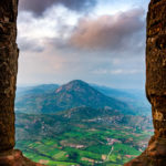
A two-hour drive from Bangalore towards the northern exit, Makalidurga is situated amidst the new colonies and industrial area of Doddaballapur taluk. Towards Gowribidanur highway from the junction, there is a pathway after fifteen kilometers. After passing through the Ghat and crossing the railway station, there is an Ecotourism board. A kilometer more from there leads to the hillock base.
On the way, the trekkers will pass through many farms, fields, hillocks, and beautiful ghats. Good roads, fresh air, and low traffic make the drive exhilarating. Across the valley, and a chain of hillocks comes Makalidurga hillock. This is the highest hillock range.
Makalidurga was also popularly known as Gunjar Hill. At the base of this hillock is a petite village on both sides of the highway. You can find small hotels, bakeries, and pit stops here. There are two versions as to why this hillock was called Makalidurga. First Version – According to Bangalore Gazette, in the seventeenth century there was a Paleghar named “Makaliraya.” As he used to be the caretaker of this place and had built a fort atop, this hillock came to be known as Makalidurga. As per the second version – Makalidurga got its name from “Makali” root which was found on this hillock.
Adventure unlimited –
Makalidurga is the nearest railway trek to Bangalore. After crossing the railway track take a left. Here begins the trek after a 2-km walk on the railway track. On the pinnacle of this hillock, there is a temple dedicated to Lord Krishna. It takes approximately an hour and a half with a decent break to reach this hillock.
Makalidurga trek is of a medium/difficult level. Once you reach the hillock top, you can find the abandoned and ruined parapet. There is also a Lord Shiva temple facing towards the East direction, where Nandi hills can be visible on a clear day.
While you start getting down the hillock and reach half of the stretch, there is a huge boulder. This is where we do Rappelling activity with the safety gears.
There is a public notice by the Karnataka Forest Department as follows: “Makali hills comes under Makali Reserve Forest. This place is under the supervision of the Doddaballapur forest department. A lot of refreshments are advised to be carried in case one wants to trek this hillock.
Nearby places to explore

Ghati Subramanya

Nandhi hills

Hulakadi betta

Skandagiri
Places to stay

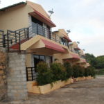
Green Valley resort

Karma kasa

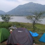
Lake side alpine-style camping

The Nature's village


