Facts:
- Distance from Bangalore: 465.9km (8hrs 26 minutes via NH44)
- Terrain: Hilly Region
- Type: Forest Area
- Total Trek/Hike Kilometer: 8kms
- Difficulty Level: Medium to Difficult
- Forest Type: Lush Greenery
- Altitude: 2,133mtres (Approximately 6,998ft as per Metre to Feet converter software)
How to reach Kodaikanal ?
Bus:
You can opt for a bus from Madurai Arapalayam or Batlangudu. Frequent buses are available from these two places to Kodaikanal. Buses are also accessible from Palani, Oddanchatram, Kodai road, and Dindigul.
It takes 2-3hrs to reach Kodaikanal via precipitous and winding ghats from Palani, Oddanchatram, or Batlagundu. As this stretch is very nice, you will enjoy the bus ride. You can even have a good time exploring the scenic beauty of the Palani hills. There is a 49-kilometer (30 mi) shortcut road from Periyakulam to Kodaikanal via Kumbakarai and Adukkam.
Train:
The nearest railway stations are Palani Station (64 kilometers or 40 miles) north, Kodaikanal Road Station (80 kilometers or 50 miles) southeast, Oddanchatram Railway Station (90 kilometers or 56 miles) northeast, Dindigul Junction (100 kilometers or 62 miles) east, and Madurai Junction (114 kilometers or 71 miles) towards east.
Airplane:
Almost all distances from Kodaikanal are calculated with the lake as the central point of reference.
The nearest airports are as follows:
Madurai International Airport (115 kilometers or 71 miles), Coimbatore International Airport (170 kilometers or 110 miles), Tiruchirapalli International Airport (197 kilometers or 122 miles), and Tuticorin Airport (262 kilometers or 163 miles).
About the Place :
Kodaikanal is a hill station situated in the district of Dindigul in Tamilnadu State. Kodaikanal means “The Gift Of The Forests” in the language of Tamil. It is also known as “Princess” of Hill stations and is considered one of the popular travel destinations in Tamilnadu. Established in the year 1845, Kodaikanal was built as a refuge from the high temperatures and tropical diseases of the plains.
The earliest residents of Kodaikanal were the Palaiyar tribal people. The references to Kodaikanal and the Palani Hills are found in Tamil Sangam literature of the early Common era. Modern Kodaikanal was established by American Christian missionaries and British bureaucrats in 1845. Tourism has been impacted by industrial pollution issues including the closure of a mercury factory owned by Unilever’s Indian subsidiary Hindustan Unilever after evidence of widespread mercury pollution.
This magnificent hill station is set in an area of granite cliffs, forested valleys, lakes, waterfalls, and grassy hills.
At 2,133 meters above sea level, the town is situated around man-made, star-shaped Kodaikanal Lake, bordered by evergreen forest. Rowing boats can be hired. It is also an ideal place for hikers and cyclists who can follow the 5k Lake Road path around the shore. The good time to visit Kodaikanal is between October to March during the winter season and if at all you are keen to visit in the summer/monsoon season, then the best period will be from April to June and July to September respectively.
Trekking
One of the significant trekking spots in Tamilnadu, Kodaikanal is a paradise for nature lovers and ardent trekkers. Nestled amidst the lush green forest, and breathtaking beauty around, this hill station is truly a delight to visit.
Trek to Canopy hills ~ Vattakanal
Vattakanal trek is one of the less explored trails of Tamilnadu. The difficulty level is similar to the Kumara Parvatha trek, and it is a medium to difficult level for an experienced trekker to scale this hillock. The entire trekking distance is 16kms. As it will be hard to climb this precipitous hill, inexperienced trekkers should not try mounting the Vattakanal hillock. Situated in the Western Ghats amidst the dense forest and hidden waterfalls lies this magnificent hillock. The view from this hillock is spectacular.
On Day one:
Though the initial part of this trekking seems easy-medium, once you enter the forest the trail from there goes steeper to climb making it a tiresome adventure. On the way, you might spot a few wild animals such as Bisons, Wild Goats, and Porcupines. The mist-laden forest path gives you an eerie feeling. Camping is allowed on this hill. After 10kms of trekking, you’ll reach a place called Vellagavi. This petite village consists of just 50 houses with no road connectivity.
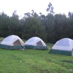
Oranges, Butter Fruit, Papaya, Banana, Guava, Passion Fruit, and Jackfruit are some of the variety of fruits available in this village. You can have your fill with delicious fruits to boost your energy. Fruit sellers of this village have to either go down to Kumbakarai or climb up to Vattakanal to sell the fruits and spices which are grown in abundance. Deep in the jungle you can set-up your tents and retire that night.
Day two:
It is more tedious the second day as the path is winding, continuously steep, and looks spooky hiking amidst the mist. It takes three hours to hike this hill and concludes at the Dolphin’s Nose in Vattakanal. To get rejuvenated from the tiresome trekking, you can sip a hot cup of lemon tea in this place.
Kodai to Munnar trek
The trek begins from Kodaikanal, which is one of the most beautiful hill stations in Tamilnadu, and ends at Top Station near Munnar. To reach Munnar from Kodaikanal, you need to trek for 32-35kms. Trek altitude is 2,690 meters, and the difficulty level is easy. The trek is divided into four parts.
In Part One – The trail starts from Kodaikanal to Vellagavi. The distance of the trek is 8-9kms. The terrain is rough and uneven. You will come across various varieties of butterflies and flowers en route. It takes approximately 7hrs to complete this trek. After seven hours of trekking, you will reach Vellagavi town. Vellagavi is a small sacred town, where trekkers won’t be allowed to wear shoes/slippers here. Even the locals roam in this village barefooted.
Part 2 – Vellagavi to Kurangini:
The distance of the trek is the same as the previous part. On the way, you will come across an ancient temple and a wonderful waterfall. The trek ends after reaching the Tamilnadu border. You can take a bus from there to reach Kurangini in Kerala.
Part 3 – Trek from Kurangini to Central Station:
Though the trekking terrain is medium in the beginning, it becomes hard as it gets steeper with uneven roads. There is also a fascinating lake amid the trail. While you scale higher, the trekking becomes more difficult as it is precipitous. Going a bit further, you will reach the Central Station base camp
Part 4 – Trek from Central Station to Munnar through jeeps:
This route takes four hours to complete. It is not that difficult to trek this stretch, as the path is slightly upwards. The view is very scenic, and you can stop-over to click a few pics of the beautiful nature. After trekking for a few meters, you will reach the Top Station. This place is the major trekking attraction and is considered the highest point of the trek. From here, you can hire a jeep to reach Munnar. There are many tourist spots like the Rose Garden, Botanical Garden, Echo Point, and Mattupetty Dam en route to Munnar.
Places to explore in and around Kodaikanal
Green Valley View:
Formerly known as a suicide point, this valley offers a spectacular view of the plains, deep valleys, and hills. The scenic beauty of Vaigal Dam is an attraction here. It used to be known as a suicide point because of its dense valley situated at more than 5000ft below. Just 5.5kms from Kodaikanal lake, this valley has a wonderful view. Beware of the monkeys when you visit this place. On your way back, you can shop for homemade chocolates, ornaments, and a vast variety of flowers.
Kodai Lake:
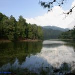
Kodaikanal lake is a manmade lake built by Vera Levinge. The Lake was later developed by the British, and early missionaries from the USA. The star-shaped lake is centrally located in Kodaikanal and is surrounded by the rich green Palani Hills Range, which is the main watershed for the lake. Situated at a height of 2285m above sea level, it has an average depth of 3.0m. This Lake is at a distance of 3 km from the Kodai Bus stand.
Bear Shola Falls:
Situated at just 2kms from the Kodaikanal Lake, Bear Shola Falls is one of the famous tourist spots in Kodaikanal. The waterfall looks beautiful during the monsoon season. As per folklore, a bear used to visit this waterfall frequently to quench its thirst. Hence from that day, this waterfall came to be called Bear Shola Falls. There are many rare species of animals and plants found amid the lush green forest in this place.
Pillar Rocks:
Situated in Kodaikanal, this tourist place has become one of the best picnic spots. Consisting of a beautiful mini garden, Pillar Rocks got its name from the three vertically positioned boulder rocks which are at an altitude of 400ft. This tourist place as per a legend was a piece of evidence for a great love story. The ‘white cross’ which once existed on these rocks represented David Gell’s excellent tribute to love. The view of these rocks is amazing. The pillars are well-known for offering a beautiful view of the nearby surroundings. The chambers between these three mammoth rocks are known as Devil’s Kitchen. Rarely, you’ll find these rocks covered with mist. However, when it is visible, this place is astounding. You can come and relax here having a bite of the delicious onion and potato bhajis served outside the mini garden.
Devil’s Kitchen:
A natural and unique heritage site also known as the Devil’s Kitchen or the Guna Caves are situated on the outskirts of the town of Kodaikanal which can be reached from the Moir Point. Earlier, this place was not a renowned tourist spot, nevertheless after a Tamil movie called Guna was shot in this place in the year 1992, it became popular. This is a group of caverns located amidst the three huge boulders known as Pillar Rocks.
This place is best suited for photographers as it will be encompassed with thick clouds in the monsoon and winter seasons. Devil’s kitchen was discovered by an English Officer known as BS Ward in 1821 CE. The caves are situated at an elevation of 2230 meters. Everything apart, the place is also very much accessible since it is located just 8.5 km away from Kodaikanal Bus Station and 1.5 km away from Pillar Rocks. This is the most visited place in Kodaikanal.
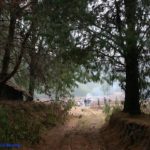
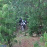
The path to the caves goes through an exquisite pine forest with the roots of the trees emerging onto the ground giving a unique setting to the place. The path to the caves goes through an impeccable pine forest with the roots of the trees emerging towards the ground giving a unique setting to the place. The cave can be viewed from a distance by visitors since its surroundings remain closed due to security reasons. The visitors get a sight of the beautiful valleys and the Pillar Rocks on a bright day.
Though there are a few more interesting places to see in and around Kodaikanal, the list goes on and on…
Nearby places to explore from Kodaikanal
- Berijam Lake
- Thaliyar Waterfalls
- Manjalar Dam
- Kumbakkarni waterfalls
- Kallar Waterfalls
- Chaturangaupara view point
- Mathiketta Shola National Park.
- Pambar waterfalls
- Shenbaganur museum
- Perumalamalai trekking
- Mannavanur Lake
- Anjuveedu waterfalls
Spiritual places to explore from Kodaikanal
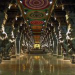
Madurai
Meenakshi temple
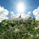
Palani
Murugan
temple
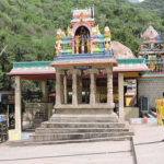
Sri Amanalingeshwar temple
